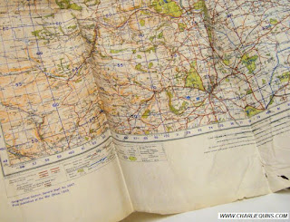
The ordnance survey maps listed below are for sale and will all be listed on Ebay (if not already listed) all starting at 99p and no reserve. There is up to 99% OFF shipping discount for each additional item won.
I post every day, WORLDWIDE, by 2pm if paid for by 11am that day. Or they will be posted the very next day and will be packaged to ensure they arrive safely.
The descriptions and photographs are guaranteed to be 100% accurate and created to the best of my knowledge & skills. If you are not 100% satisfied then please return and you will be refunded in full plus return postage. If you wish to learn more about the maps you are interested in then please do not hesitate to ask for to see more photos or for more information.
The Ordnance Survey Maps
The maps are vibrant and look almost as good as the day they were printed. The borders show signs of age with the usual marks,stains and the occassional small tears.
Over the next week I will start listing the ordnance survey maps here and also for sale on Ebay. The following photographs of each ordnance survey map are below and I have a lot more to photograph and list.
Thanks for looking
WREXHAM AND OSWESTRY WAR OFFICE 1940 ORDNANCE SURVEY MAP
The ordnance survey map is a War Office 1940 revision on sheet 51 and was first published in 1932.
SHREWSBURY WELSHPOOL COLLECTIBLE 1940 ORDNANCE SURVEY MAP
The ordnance survey map is a Second War Office 1940 revision on sheet 60.
ABERGAVENNY COLLECTABLE 1940 WAR OFFICE ORDNANCE SURVEY MAP
The ordnance survey map is a Second War Office 1940 revision on sheet 91.
LLANDRINDOD WELLS COLLECTABLE ORDNANCE SURVEY 1931 MAP
The ordnance survey map was published at the War Office in 1932 on sheet 79.
MORE ORDNANCE SURVEY MAPS COMING SOON


No comments:
Post a Comment